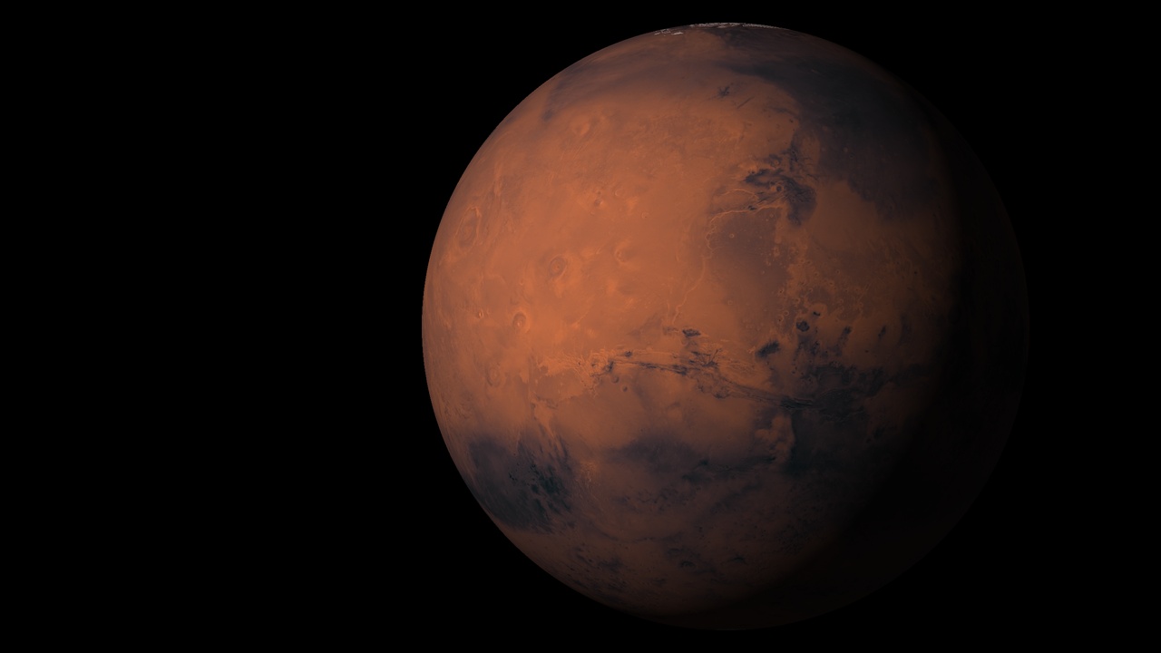
Mars 3D model and interactive map
This is an interactive 3D model of Mars with a flat map mode. It uses real elevation data, IAU place names and the landing sites and traverse paths of every rover and lander that has reached the surface. Rotate the globe, search any named feature and measure distances across the terrain. Mars is about half the diameter of Earth, and its surface area is close to Earth’s total land area. The terrestrial planets page shows how it compares with Mercury, Venus and Earth. The 3D space models page has globes of the Moon and the other planets.
How to use the map
- Move: drag to rotate, scroll or pinch to zoom.
- Globe or flat map: use the mode switch to flip between the 3D globe and a flat map.
- Layers: toggle regions, landmarks, surface features, rovers, landing sites, rover traverse paths, the latitude/longitude grid, live day and night, and the moons Phobos and Deimos.
- Search: type any named feature to fly to it.
- Info: click a feature or mission to open its info panel.
- Readout: latitude, longitude and elevation appear under the cursor.
- Terrain exaggeration: raise it to make relief visible from orbit.
- Measure: pick two points to get the distance and an elevation profile between them.
- Time: scrub the time slider to move the day/night line and the moons.
- Share: copy a link to the current view.
Mars geography in brief
The crustal dichotomy
Mars has two halves. The northern lowlands cover about a third of the planet and sit kilometres lower than the southern highlands, which cover the rest. The crust is about 32 km thick in the north and 58 km in the south. The cause is unresolved: one giant impact, many impacts or mantle convection, all early in the planet’s history. The boundary crosses regions such as Arabia Terra.
Tharsis and Olympus Mons
Tharsis is a volcanic plateau about 5,000 km across, rising roughly 7 km above its surroundings. It carries the three Tharsis Montes volcanoes, each 375 to 475 km wide and spaced about 700 km apart. About 1,200 km northwest of them stands Olympus Mons, the tallest volcano in the Solar System. Its summit is about 21.3 km above the Mars datum (the reference surface for elevation). Measured from the low plains of Amazonis Planitia to the northwest, the climb reaches up to 26 km. The shield is about 600 km wide.
Valles Marineris
Valles Marineris is the largest canyon in the Solar System: about 4,000 km long, up to 600 km wide and up to roughly 7 km deep below the adjacent plateau. NASA gives 9.3 km for its deepest point. It is thought to have formed as the Tharsis region rose and the crust beside it cracked.
Hellas
Hellas Planitia is an impact basin about 2,300 km across in the southern hemisphere. Its floor lies about 7 km below the datum and more than 9 km below its rim. It formed between 4.1 and 3.8 billion years ago. Its floor holds the lowest elevations on Mars, so the air pressure there is the highest on the planet.
The polar caps
The north cap, Planum Boreum, is about 1,000 km across and up to 3 km thick, mostly water ice. The south cap, Planum Australe, is about 350 km across and holds a similar volume of ice under a permanent carbon dioxide layer about 8 m thick. Each winter a seasonal frost of carbon dioxide 1.5 to 2 m deep spreads over each pole, so the caps grow and shrink with the seasons.
Rovers and landing sites
Every successful and failed landing is on the map, with traverse paths for the rovers. For the full timeline see the history of Mars missions. Viking 1 and 2 are covered in the search for life on Mars, and Spirit and Opportunity in the Mars Exploration Rover missions. Coordinates are landing sites in planetocentric degrees north and east. Status is as of 2 October 2026.
| Mission | Agency | Landed | Site | Coordinates | Status |
|---|---|---|---|---|---|
| Mars 3 | USSR | 1971-12-02 | Near Ptolemaeus Crater (nominal) | 45.04°S, 202.02°E | Failed: transmitted about 110 s |
| Viking 1 | NASA | 1976-07-20 | Chryse Planitia | 22.27°N, 312.05°E | Ended 1982 |
| Viking 2 | NASA | 1976-09-03 | Utopia Planitia | 47.64°N, 134.29°E | Ended 1980-04-11 |
| Pathfinder / Sojourner | NASA | 1997-07-04 | Ares Vallis | 19.13°N, 326.78°E | Ended 1997-09-27 |
| Beagle 2 | UK / ESA | 2003-12-25 | Isidis Planitia | 11.53°N, 90.43°E | Failed: landed, never communicated |
| Spirit | NASA | 2004-01-04 | Gusev Crater | 14.57°S, 175.47°E | Ended 2010 (last contact 2010-03-22) |
| Opportunity | NASA | 2004-01-25 | Meridiani Planum | 1.95°S, 354.47°E | Ended 2018 (last contact 2018-06-10) |
| Phoenix | NASA | 2008-05-25 | Vastitas Borealis | 68.22°N, 234.25°E | Ended 2008-11 |
| Curiosity | NASA | 2012-08-06 | Gale Crater | 4.59°S, 137.44°E | Active |
| Schiaparelli | ESA | 2016-10-19 | Meridiani Planum | 2.05°S, 353.79°E | Failed: crashed |
| InSight | NASA | 2018-11-26 | Elysium Planitia | 4.50°N, 135.62°E | Ended 2022-12-21 |
| Perseverance / Ingenuity | NASA | 2021-02-18 | Jezero Crater | 18.44°N, 77.45°E | Perseverance active; Ingenuity ended 2024-01-25 |
| Zhurong | CNSA | 2021-05-14 | Utopia Planitia | 25.10°N, 109.91°E | Inactive since 2022-05 |
Curiosity passed 5,000 sols in September 2026. Perseverance passed marathon distance (42.195 km) on sol 1,890 in June 2026. Zhurong went into winter hibernation in May 2022 and has not woken. Orbiter images show it has not moved, and Chinese mission officials have said dust on its solar panels may keep it dormant for good. Mars 3 transmitted for about 110 seconds, and its landing point has never been confirmed. Beagle 2 was found intact on the surface in 2015 with one solar panel unopened.
Where the data comes from
- Colour: Viking MDIM2.1 colorized mosaic, USGS Astrogeology Science Center.
- Elevation: Mars Global Surveyor MOLA digital elevation model (NASA/GSFC).
- Names: IAU Gazetteer of Planetary Nomenclature (USGS).
- Rover paths: NASA/JPL.
- Close-ups: CTX mosaic, Murray Lab, Caltech.
- Day/night and moons: approximate positions from the Mars24 algorithm (Allison and McEwen, 2000) and published orbital elements.
The moons Phobos and Deimos are drawn at their calculated positions. For how far Mars sits from Earth, see how far away each planet is. The same kind of model exists for the Moon, Mercury, Venus, Earth, Jupiter, Saturn, Uranus and Neptune.
Questions people ask
Is there a 3D map of Mars?
Yes. This page is an interactive 3D map and model of Mars built from NASA Mars Global Surveyor elevation data and the Viking colour mosaic. You can rotate the globe, switch to a flat map, search named features, view rover paths, measure distances and exaggerate the terrain relief.
How big is Mars compared to Earth?
Mars is about half the size of Earth. Its mean radius is 3,389.5 km against Earth's 6,371 km, so its diameter is about 53 percent of Earth's. It has about 11 percent of Earth's mass, 38 percent of Earth's surface gravity, and a surface area close to Earth's total land area.
Where is Perseverance now?
Perseverance is in the Jezero crater region, where it landed on 18 February 2021, and it is still active. It began climbing the crater rim in 2024 and passed 42 km of driving in June 2026. Turn on the rover traverse layer to see its path and last known position.
What is the tallest mountain on Mars?
Olympus Mons, a shield volcano about 600 km wide, is the tallest mountain on Mars and in the Solar System. Its summit is about 21.3 km above the Mars datum, and the climb from the low plains northwest of it is up to 26 km. For comparison, Mount Everest rises 8.8 km above sea level.
How do Mars coordinates work?
Mars uses latitude from the equator and longitude measured east from a prime meridian through the small crater Airy-0, from 0 to 360 degrees. Elevation is measured from the Mars datum, a reference surface defined from altitude and gravity data. This map shows planetocentric latitude and east longitude.
Where did each rover land?
Sojourner landed in Ares Vallis, Spirit in Gusev Crater, Opportunity on Meridiani Planum, Curiosity in Gale Crater, Perseverance in Jezero Crater and Zhurong on Utopia Planitia. Landers touched down at Chryse Planitia, Utopia Planitia, Elysium Planitia and near the north pole. Each site is marked on the map with its coordinates.