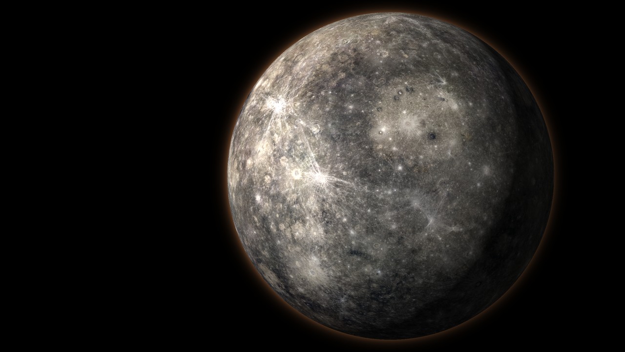
Mercury 3D map and interactive globe
This is an interactive 3D map of Mercury with a flat map mode. The surface comes from NASA’s MESSENGER spacecraft, which orbited Mercury from 2011 to 2015 and photographed all of it. The globe carries 560 IAU place names, the points MESSENGER passed over on its three flybys, the spot where MESSENGER crashed into the surface and the orbits of MESSENGER and the two BepiColombo orbiters. A countdown tracks BepiColombo, the European and Japanese mission that enters orbit around Mercury on 21 November 2026. Mercury is the smallest planet, 4,880 km across and 38 percent of Earth’s diameter. The characteristics of Mercury post covers the planet itself. Mars and Venus have their own globes on the 3D space models page.
How to use the map
- Move: drag to rotate, scroll or pinch to zoom.
- Globe or flat map: use the mode switch to flip between the 3D globe and a flat map.
- Layers: toggle regions, landmarks, surface features, the MESSENGER impact site, MESSENGER flyby points, orbits, the latitude/longitude grid and live day and night.
- Enhanced colour: switch from Mercury’s true grey to MESSENGER’s enhanced-colour map, which exaggerates differences in the rock. Young volcanic plains turn orange, dark low-reflectance material turns deep blue and fresh crater rays show pale blue.
- Missions: open the missions panel for Mariner 10, MESSENGER and BepiColombo with every flyby dated. Click an orbiter to show its orbit or a MESSENGER flyby to fly to the point it passed over.
- Search: type any named crater, scarp or plain to fly to it.
- Readout: latitude, longitude, elevation and local solar time appear under the cursor.
- Terrain exaggeration: raise it to make relief visible from orbit. The default is 4 times.
- Measure: pick two points to get the distance and an elevation profile between them.
- Share: copy a link to the current view.
How Mercury was mapped
Mercury is hard to photograph from Earth. It never strays more than 28 degrees from the Sun, so telescopes see it low in a bright twilight sky. The first close-up maps came from Mariner 10, which flew past three times in 1974 and 1975. Each pass came at the same point in Mercury’s day, so it saw the same sunlit side every time and mapped about 45 percent of the planet. MESSENGER finished the job. It became the first spacecraft to orbit Mercury on 18 March 2011 and over four years took more than 250,000 pictures. Its global mosaic is the colour on this globe. The elevation comes from MESSENGER’s laser altimeter and from stereo pairs of its images. The laser covered the northern hemisphere in detail, so elevations in the south are smoother on this map than the real ground.
Mercury geography in brief
Mercury looks like the Moon at first glance: grey, airless and covered in craters. Its surface is older terrain broken by smooth volcanic plains and crossed by long cliffs that no other planet has on the same scale. Elevations on this map run from about 5.4 km below the mean radius to about 4.5 km above it.
Caloris Planitia
Caloris Planitia is the largest impact basin on Mercury, about 1,500 km across, nearly a third of the planet’s diameter. The Caloris Montes, rings of mountains up to about 2 km high, mark its rim. Lava later flooded the floor, and on it MESSENGER found Pantheon Fossae, more than 200 troughs radiating like spokes from a 41 km crater, Apollodorus, at their centre. On the exact opposite side of the planet lies a patch of jumbled hills and broken crater rims. The leading explanation is that shock waves from the Caloris impact travelled through and around the planet and met there.
The great scarps
Long cliffs called rupes cross Mercury for hundreds of kilometres. They formed as the planet’s large iron core cooled and Mercury shrank, so the crust buckled and pushed up over itself. MESSENGER measured that the planet’s radius has shrunk by up to 7 km. Enterprise Rupes is the largest, about 820 km long and up to 3 km high. It cuts straight through the Rembrandt basin. Discovery Rupes and Beagle Rupes cut straight through older craters. Raise the terrain exaggeration and measure across one to see the step.
Basins and craters
Rembrandt, about 715 km wide, is the second-largest basin and was found by MESSENGER on its second flyby. Rachmaninoff holds the lowest ground on Mercury inside its double ring. Beethoven and Tolstoj are ancient basins seen first by Mariner 10. Hokusai is a young crater whose bright rays stretch more than 1,000 km. Kuiper, a young 62 km crater, is one of the brightest spots on the planet. Near the north pole, the floors of craters such as Prokofiev, Kandinsky and Chesterton never see the Sun. Radar from Earth and MESSENGER’s instruments found water ice in them.
Why the craters are named after artists
The International Astronomical Union names each kind of feature on Mercury from one theme. Craters are named after artists, writers and composers who have been famous for more than 50 years, which is how Bach, Mozart, Shakespeare, Dickens and Tolkien all have craters. Rupes are named after ships of exploration, such as Darwin’s Beagle and Cook’s Endeavour. Plains carry the word for Mercury in other languages. Borealis Planitia (north) and Caloris Planitia (heat) are the exceptions. Click any feature to read who or what it is named after.
Missions to Mercury
Only three spacecraft have visited Mercury. A spacecraft heading for Mercury falls toward the Sun, speeds up and has to shed that speed to be captured. Every mission has used flybys of Earth, Venus and Mercury itself to slow down. The full history is in space missions to Mercury.
| Mission | Agency | At Mercury | What it did |
|---|---|---|---|
| Mariner 10 | NASA | 3 flybys, 1974 to 1975 | First close-up pictures. Mapped about 45 percent and found the magnetic field. |
| MESSENGER | NASA | 3 flybys 2008 to 2009, orbit 2011 to 2015 | Mapped the whole planet, found ice at the poles and measured the shrinking. |
| BepiColombo | ESA and JAXA | 6 flybys 2021 to 2025, orbit from November 2026 | Two orbiters to study the surface, interior and magnetic field. |
MESSENGER’s last day
MESSENGER ran out of fuel in 2015. On 30 April 2015 it hit the surface at about 3.9 km/s, roughly 14,000 km/h, on the far side from Earth. The impact point is on the map near the crater Janáček. It left a new crater about 16 m wide, which BepiColombo may be able to photograph.
BepiColombo arrives
BepiColombo launched on 20 October 2018. It carries two orbiters stacked on a transfer module: ESA’s Mercury Planetary Orbiter (MPO) and JAXA’s Mio, the Mercury Magnetospheric Orbiter. After an Earth flyby, two Venus flybys and six Mercury flybys, the stack enters orbit around Mercury on 21 November 2026. The arrival was planned for December 2025 and slipped by about a year after the transfer module’s thrusters lost power in 2024. Mio separates and settles into its own orbit by about 10 December 2026, and science work begins in 2027. MPO will fly a low polar orbit, about 480 by 1,500 km, to map the surface and composition. Mio flies far wider, out to about 11,600 km, to study the magnetic field and the solar wind. Turn on the orbit layer to see both next to MESSENGER’s long, looping orbit.
A day on Mercury
Mercury turns once every 58.6 Earth days and goes around the Sun every 88. That is exactly three turns for every two orbits. The combination makes one solar day, from noon to noon, last about 176 Earth days, twice as long as Mercury’s year. At noon the ground reaches about 430 °C. With no air to hold heat, it falls to about −180 °C at night. The 3:2 spin also fixes where the Sun is overhead when Mercury is closest to the Sun: always over longitude 0 or 180 degrees, the hot poles. Caloris sits close to one of them, which is how it got its name, Latin for heat. The day and night layer and the local solar time readout follow this rotation. Run the clock to watch it. More on the long day is in a day on Mercury is longer than its year.
Questions people ask
Is there a 3D map of Mercury I can explore online?
Yes. This page is an interactive 3D map and model of Mercury built from NASA MESSENGER images and elevation data. You can rotate the globe, switch to a flat map, search 560 named features, switch to MESSENGER's enhanced-colour view, see where MESSENGER flew past and crashed and follow the orbits of MESSENGER and BepiColombo.
How was Mercury mapped?
Mariner 10 mapped about 45 percent of Mercury during three flybys in 1974 and 1975. NASA's MESSENGER orbited Mercury from 2011 to 2015, took more than 250,000 pictures and imaged the whole planet. Its laser altimeter and stereo images give the elevation used on this globe.
What is the biggest crater on Mercury?
Caloris Planitia, an impact basin about 1,500 km across, nearly a third of Mercury's diameter. Rings of mountains up to about 2 km high mark its rim, and lava later flooded its floor. Rembrandt, about 715 km wide, is the second largest.
When does BepiColombo arrive at Mercury?
BepiColombo enters orbit around Mercury on 21 November 2026. JAXA's Mio orbiter separates and settles into its own orbit by about 10 December 2026, and science work starts in 2027. The arrival slipped from December 2025 after the spacecraft's thrusters lost power in 2024.
What is the difference between BepiColombo's MPO and Mio?
BepiColombo carries two orbiters. ESA's Mercury Planetary Orbiter (MPO) flies a low polar orbit, about 480 by 1,500 km, to map the surface, composition and interior. JAXA's Mio, the Mercury Magnetospheric Orbiter, flies a wide orbit out to about 11,600 km to study Mercury's magnetic field and the solar wind.
How many spacecraft have visited Mercury?
Three: NASA's Mariner 10 (three flybys, 1974 to 1975), NASA's MESSENGER (three flybys and four years in orbit, 2008 to 2015) and ESA and JAXA's BepiColombo (six flybys from 2021 to 2025, then orbit from November 2026).
Why are Mercury's craters named after artists?
The International Astronomical Union names each kind of feature on Mercury from one theme. Craters are named after artists, writers and composers famous for more than 50 years, such as Bach, Beethoven, Rembrandt and Tolkien. Scarps are named after ships of exploration and plains after the word for Mercury in other languages.
How long is a day on Mercury?
Mercury turns once every 58.6 Earth days, but one solar day, from noon to noon, lasts about 176 Earth days. That is twice as long as its 88-day year, because Mercury spins three times for every two orbits.
Is there ice on Mercury?
Yes. The floors of some craters near the poles, such as Prokofiev and Kandinsky, never see the Sun and stay below about -170 degrees C. Radar from Earth and MESSENGER's instruments found water ice in them.
How big is Mercury compared with Earth?
Mercury is 4,880 km across, 38 percent of Earth's diameter and smaller than Jupiter's moon Ganymede. Earth is about 2.6 times wider.
Where the data comes from
- Colour: MESSENGER MDIS global colour mosaic and MDIS enhanced-colour mosaic, USGS Astrogeology Science Center.
- Elevation: MESSENGER global digital elevation model (Becker et al., 2016), USGS Astrogeology Science Center.
- Names: IAU Gazetteer of Planetary Nomenclature (USGS).
- Missions: NASA, the Johns Hopkins Applied Physics Laboratory, ESA and JAXA. Flyby points marked approximate are estimated from published closest-approach data.
- Orbits: published orbital elements. Orbit orientation is approximate and spacecraft positions are illustrative. BepiColombo’s orbits are the planned science orbits.
- Day and night: calculated from the IAU rotation model for Mercury and checked against JPL Horizons.
Data verified 2026-10-04. The same kind of model exists for the Moon, Venus, Earth, Mars, Jupiter, Saturn, Uranus and Neptune. To compare the inner planets, read Mercury vs Mars and the Mercury and Venus comparison.