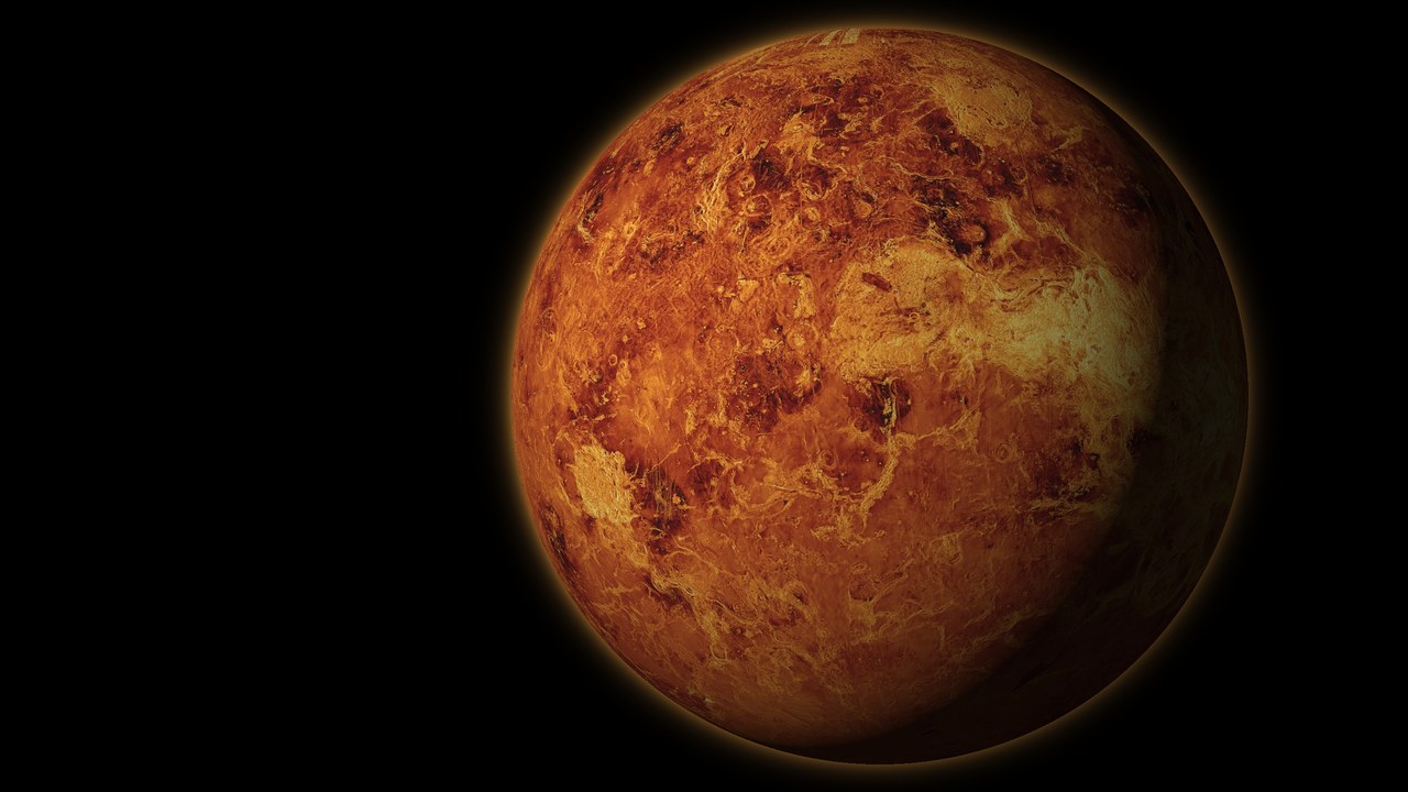
Venus 3D map and interactive globe
This is an interactive 3D map of Venus with a flat map mode. The surface comes from NASA’s Magellan radar, which saw through the clouds and mapped 98 percent of the planet between 1990 and 1994. The map carries 1,419 IAU place names, the landing and impact sites of every Venera, Vega and Pioneer Venus probe, the drift tracks of the two Vega balloons and the orbits of eight spacecraft. A descent panel shows temperature, pressure and wind from the ground to 100 km. Venus is 95 percent of Earth’s diameter. The Venus and Earth comparison covers how alike the two planets are and where they split. Mars and Mercury have their own globes on the 3D space models page.
How to use the map
- Move: drag to rotate, scroll or pinch to zoom.
- Globe or flat map: use the mode switch to flip between the 3D globe and a flat map.
- Layers: toggle regions, landmarks, surface features, landers and probes, balloon tracks, orbits, clouds, the latitude/longitude grid and live day and night.
- Clouds: turn on the cloud layer and set its opacity to see the planet as it looks from space. Run the clock and the cloud tops race around the planet in about four days while the ground below barely moves.
- Descent: open the descent panel and drag the altitude slider to read the temperature, pressure and wind at any height from 0 to 100 km.
- Missions: open the missions panel for every spacecraft that has reached Venus, from Mariner 2 in 1962 to the missions planned for the 2030s. Click an orbiter to show its orbit or a lander to fly to its site.
- Search: type any named feature or mission to fly to it.
- Readout: latitude, longitude, elevation and local solar time appear under the cursor.
- Terrain exaggeration: raise it to make relief visible from orbit. Venus is flatter than Mars, so the default is 12 times.
- Measure: pick two points to get the distance and an elevation profile between them.
- Share: copy a link to the current view.
How Venus was mapped through the clouds
Visible light never reaches the surface of Venus from space. A cloud deck of sulfuric acid droplets about 20 km thick hides it completely, so every map of the ground comes from radar, which passes through the clouds. Pioneer Venus Orbiter made the first global elevation map with a radar altimeter from 1978. Venera 15 and 16 mapped the northern quarter of the planet at 1 to 2 km resolution in 1983 and 1984. Magellan then mapped 98 percent of the surface at about 100 m resolution. Its radar images and altimetry are the colour and elevation data on this globe. The orange colour is a choice made by the image processors, based on the light the Venera landers recorded under the clouds. A radar image has no natural colour.
Venus geography in brief
Most of Venus is volcanic plains. Two large highlands rise above them, along with a scattering of volcanic rises. Elevations on this map run from about 3 km below the mean radius to about 11 km above it. That range is far smaller than on Earth or Mars. Venus has about 1,000 impact craters, and none smaller than about 3 km, because the thick air breaks up small meteoroids. So few craters means the surface is young: most of it is between 300 million and 1 billion years old.
Ishtar Terra and Maxwell Montes
Ishtar Terra is the northern highland, about 5,600 km across and roughly the size of Australia. Its western half is Lakshmi Planum, a plateau about 4 km high ringed by the Akna, Freyja and Danu mountain belts. On its eastern edge stand the Maxwell Montes, the highest mountains on Venus at about 11 km above the mean radius. Cleopatra, an impact crater about 105 km wide, sits on their eastern flank.
Aphrodite Terra
Aphrodite Terra runs about 10,000 km along the equator, roughly the size of South America. It is a chain of highlands: Ovda Regio in the west, Thetis Regio in the middle and Atla Regio in the east. Deep rift troughs such as Diana Chasma and Dali Chasma cut through its eastern end. South of it lies Artemis Corona, a ring structure about 2,600 km across.
Volcanoes and coronae
Venus has more volcanoes than any other planet in the Solar System. The tallest is Maat Mons in Atla Regio, a shield about 400 km wide rising about 8 km above the mean radius. In 2023 researchers compared Magellan images taken eight months apart and found a vent on Maat Mons that had changed shape and grown, the first direct evidence of an eruption on Venus. Venus Express infrared data had already pointed to recent lava flows on Idunn Mons. Coronae are a type of feature found almost only on Venus: rings of ridges and fractures hundreds of kilometres wide, formed where hot material rose under the crust and pushed it up. The flat-topped pancake domes are thick lava that spread out and stopped.
Tesserae and lava channels
Tesserae are the most deformed terrain on the planet: highlands crossed by ridges and grooves in two or more directions, like floor tiles. They are among the oldest surfaces on Venus. Alpha Regio, the target of NASA’s DAVINCI probe, is one. The plains hold lava channels too. Baltis Vallis is about 6,000 km long, the longest known channel in the Solar System.
Why almost every name is a woman’s
The International Astronomical Union reserves Venus for female names. Craters are named after famous women such as Mead, the largest crater on Venus at about 270 km. Other features take the names of goddesses and heroines from cultures around the world. Only three features break the rule because they were named before it existed: Maxwell Montes, after the physicist James Clerk Maxwell, and Alpha Regio and Beta Regio, the first two features identified by Earth-based radar.
Landing sites on Venus
Ten landers have sent data from the surface of Venus, all of them Soviet: Venera 7 to 14 and the Vega 1 and 2 landers. None lasted long. At about 462 °C and 92 bar the electronics overheat within hours, and Venera 13 holds the record at 127 minutes. Venera 9, 10, 13 and 14 sent back the only pictures ever taken on the surface. NASA’s four Pioneer Venus probes profiled the atmosphere on the way down in 1978, and the Day Probe kept transmitting for 67 minutes after impact. The story of each landing is in have we landed on Venus? Coordinates below are in degrees north and east. Some early sites are known only to the nearest degree.
| Mission | Landed | Site | Coordinates | Survived | Surface reading |
|---|---|---|---|---|---|
| Venera 7 | 1970-12-15 | Equatorial plains | 5°S, 351°E | 23 min | 475 °C, 90 bar |
| Venera 8 | 1972-07-22 | Vasilisa Regio | 10.7°S, 335.3°E | 50 min | 470 °C, 91 bar |
| Venera 9 | 1975-10-22 | Beta Regio, eastern flank | 31.0°N, 291.6°E | 53 min | 485 °C, 91 bar |
| Venera 10 | 1975-10-25 | Beta Regio, southeast of Venera 9 | 15.4°N, 291.5°E | 65 min | 465 °C, 93 bar |
| Venera 12 | 1978-12-21 | Phoebe Regio region | 7°S, 294°E | 110 min | 468 °C, 95 bar |
| Venera 11 | 1978-12-25 | Phoebe Regio region | 14°S, 299°E | 95 min | 452 °C, 94 bar |
| Venera 13 | 1982-03-01 | East of Phoebe Regio | 7.6°S, 303.7°E | 127 min | 457 °C, 90 bar |
| Venera 14 | 1982-03-05 | East of Phoebe Regio | 13.3°S, 310°E | 57 min | 465 °C, 95 bar |
| Vega 1 | 1985-06-11 | Rusalka Planitia | 7.2°N, 177.8°E | 20 min | Not recorded |
| Vega 2 | 1985-06-15 | North of Aphrodite Terra | 6.5°S, 181.1°E | 56 min | 463 °C, 92 bar |
Venera 13 took the first colour pictures of the surface and recorded the first sounds from another planet. Its soil was a basalt similar to volcanic rock on Earth. Vega 2 found a feldspar-rich rock closer to the ancient highland crust of the Moon. The Vega landers also released two balloons that floated at about 54 km for 46 hours each and drifted about 11,000 km west on the cloud-level wind. Turn on the balloon layer to see their tracks.
The atmosphere of Venus by altitude
The air on Venus is 96.5 percent carbon dioxide. At the surface the pressure is about 92 times Earth’s sea-level pressure, the same as 900 m under the ocean. The descent panel follows the standard Venus atmosphere model (VIRA) from the ground up.
- 0 km: about 462 °C and 92 bar. The heat is the same day and night and from equator to pole, because the thick air spreads it evenly. Lead would melt.
- 30 to 48 km: a clear lower haze. The temperature falls by about 8 °C per kilometre of height.
- 48 to 70 km: the three cloud decks, lower, middle and upper, made of sulfuric acid droplets. They reflect about 75 percent of sunlight, which is why Venus is the brightest planet in the night sky.
- 50 to 55 km: the most Earth-like place in the Solar System outside Earth. The pressure falls from about 1 bar to 0.5 bar and the temperature from about 75 °C to 27 °C. The question of life in this layer is covered in is Venus habitable?
- 70 km: the cloud tops, at about −43 °C. This is the layer seen in telescope and spacecraft photos.
The ground turns once every 243 Earth days, backwards compared with most planets. The cloud tops are far faster. Winds of about 100 m/s carry them around the planet in about four days, 60 times faster than the planet turns. This is called super-rotation. At the surface the wind is about walking pace, under 1 m/s. One solar day on Venus, from one sunrise to the next, lasts 116.75 Earth days, and the Sun rises in the west.
Spacecraft that have orbited Venus
Eight orbits are on the map, drawn from published orbital elements. Turn on the orbit layer and zoom out to see them.
- Venera 9 and 10 (1975 to 1976): the first spacecraft to orbit Venus. They relayed the first surface pictures from their landers.
- Pioneer Venus Orbiter (1978 to 1992): the first global elevation map, made with a radar altimeter, and 14 years of measurements of the upper atmosphere.
- Venera 15 and 16 (1983 to 1985): radar maps of the northern quarter of the planet.
- Magellan (1990 to 1994): radar maps of 98 percent of the surface. Its last task was a planned dive into the atmosphere.
- Venus Express (2006 to 2014): ESA’s orbiter. It mapped the double vortex over the south pole and found infrared signs of fresh lava.
- Akatsuki (2015 to 2025): JAXA’s orbiter. It photographed a stationary wave about 10,000 km long in the clouds and tracked the super-rotation. JAXA ended the mission on 18 September 2025.
Next come NASA’s VERITAS radar orbiter and DAVINCI descent probe and ESA’s EnVision radar orbiter. All three are planned to launch in the early 2030s. The missions panel lists every flyby as well, from Mariner 2 in 1962 to Parker Solar Probe and BepiColombo. The reasons to explore Venus post covers what the next missions are looking for.
Questions people ask
Is there a 3D map of Venus?
Yes. This page is an interactive 3D map and model of Venus built from NASA Magellan radar images and elevation data. You can rotate the globe, switch to a flat map, search 1,419 named features, see every landing site, turn on the clouds, follow the orbits of eight spacecraft and read the atmosphere at any altitude.
What does the surface of Venus look like?
Most of Venus is volcanic plains of basalt, broken by two large highlands, Ishtar Terra and Aphrodite Terra, and by thousands of volcanoes. The Venera landers photographed flat slabs of rock under a dim orange sky. The surface is young, mostly 300 million to 1 billion years old, so it has only about 1,000 impact craters.
How do we map Venus if clouds hide the surface?
With radar. Radio waves pass through the clouds, so orbiters bounce radar off the ground to image it and measure its height. NASA's Magellan mapped 98 percent of the surface this way between 1990 and 1994 at about 100 m resolution. Earlier maps came from Pioneer Venus Orbiter and the Soviet Venera 15 and 16 orbiters.
Has anyone landed on Venus?
Ten Soviet landers have sent data from the surface: Venera 7 to 14 in 1970 to 1982 and Vega 1 and 2 in 1985. Venera 7 was the first, on 15 December 1970. Venera 9, 10, 13 and 14 took pictures. No lander has worked for more than about two hours because of the heat and pressure.
How long did Venera 13 survive on Venus?
Venera 13 worked for 127 minutes on the surface on 1 March 1982, the longest of any Venus lander. It took the first colour pictures of the surface, analysed a soil sample with an X-ray spectrometer and recorded the first sounds from another planet.
What is the highest point on Venus?
Maxwell Montes, a mountain range on the eastern edge of Ishtar Terra, reaches about 11 km above the planet's mean radius. It is one of only three features on Venus named after a man, the physicist James Clerk Maxwell. The tallest single volcano is Maat Mons, about 8 km high.
How hot is Venus and how does it change with altitude?
The surface is about 462 C at a pressure of 92 bar, the same day and night. The temperature falls by about 8 C per kilometre of height. At 50 km it is about 75 C at 1 bar, at 55 km about 27 C at half a bar, and at the cloud tops near 70 km about -43 C.
Could humans survive anywhere on Venus?
Only high in the atmosphere. Between about 50 and 55 km the pressure is close to Earth's at sea level and the temperature is between 75 C and 27 C. The air is still carbon dioxide and the clouds are sulfuric acid, so it is the most Earth-like environment in the Solar System only in pressure and temperature.
Why does Venus spin backwards and how long is its day?
Venus rotates once every 243 Earth days in the opposite direction to most planets, probably because of giant impacts or tides acting on its thick atmosphere early in its history. Because it turns backwards while orbiting the Sun every 225 days, one sunrise-to-sunrise day lasts 116.75 Earth days and the Sun rises in the west.
Is Venus volcanically active?
Yes, the evidence says it is. In 2023 scientists found a vent on Maat Mons that changed shape and grew between two Magellan radar passes eight months apart in 1991, the first direct sign of an eruption. Venus Express infrared data had already suggested young lava flows on Idunn Mons.
Which missions are going to Venus next?
NASA's VERITAS radar orbiter and DAVINCI descent probe and ESA's EnVision radar orbiter are all planned to launch in the early 2030s. DAVINCI will drop through the atmosphere and photograph the Alpha Regio tessera on the way down. VERITAS and EnVision will map the surface at higher resolution than Magellan.
Where the data comes from
- Colour and elevation: Magellan C3-MDIR colorized mosaic and Magellan global topography, USGS Astrogeology Science Center.
- Names: IAU Gazetteer of Planetary Nomenclature (USGS).
- Landing sites and mission facts: NASA, ESA, JAXA and published mission reports. Early Soviet landing points are approximate.
- Atmosphere: Venus International Reference Atmosphere (Seiff et al., 1985). Winds are a composite of probe measurements.
- Orbits: published orbital elements. Orbit orientation is approximate and spacecraft positions are illustrative.
- Day and night: calculated from the IAU rotation model for Venus and checked against JPL Horizons.
Data verified 2026-10-03. The same kind of model exists for the Moon, Mercury, Earth, Mars, Jupiter, Saturn, Uranus and Neptune. To see Venus for yourself, the planets visible from Earth guide explains when to look.