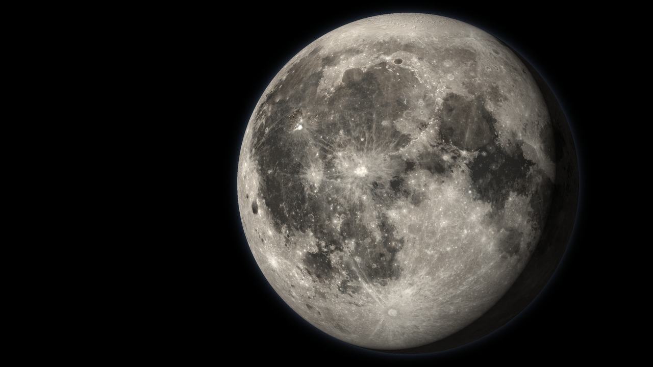
Interactive Moon map and 3D model
This is an interactive 3D model of the Moon with a flat map mode. The surface is built from NASA’s Lunar Reconnaissance Orbiter (LRO): its wide-angle camera gives the colour and its laser altimeter gives the relief. The map carries about 1,500 named craters, seas, mountains and valleys from the International Astronomical Union, every spacecraft that has landed or crashed on the Moon, the tracks of the Apollo astronauts and the Lunokhod and Yutu rovers, and an observing guide that lists what is worth pointing a telescope at on any night. Sunlight falls where it really falls today, so the globe shows the current phase. The Moon is 3,475 km across, about 27 percent of Earth’s diameter. The characteristics of the Moon post covers the Moon itself. Mars, Venus and Mercury have their own globes on the 3D space models page.
How to use the Moon map
- Move: drag to rotate, scroll or pinch to zoom.
- Globe or flat map: use the mode switch to flip between the 3D globe and a flat map of the whole Moon.
- Layers: toggle seas, landmarks, named features, landing sites, rover and astronaut tracks, observing targets, the latitude and longitude grid and day and night.
- Landings: open the landings panel for every mission from Luna 2 in 1959 to 2025, grouped by programme. Click one to fly to the site and show its track.
- Observing: open the observing panel to see the phase, the targets near the day and night line tonight, and what size of telescope each one needs.
- Time: move the clock to any date to see the phase and the lighting for that night.
- Search: type any named crater, sea or mountain to fly to it.
- Readout: latitude, longitude, elevation and local lunar time appear under the cursor.
- Terrain exaggeration: raise it to make relief visible from orbit. The default is 3 times.
- Measure: pick two points to get the distance and an elevation profile between them.
- Share: copy a link to the current view.
How the Moon was mapped
Astronomers drew the near side by eye and then by photograph for 350 years, but the far side stayed unseen until the Soviet probe Luna 3 photographed it in 1959. NASA’s Lunar Orbiters mapped almost the whole Moon in 1966 and 1967 to pick landing sites for Apollo. The data on this map comes from LRO, which has orbited the Moon since June 2009. Its wide-angle camera photographs the whole Moon about once a month, and its laser altimeter, LOLA, has taken billions of elevation measurements. Elevations on this map run from about 9.1 km below the mean radius, in the South Pole-Aitken basin, to about 10.8 km above it, near the far-side crater Engel’gardt.
Lunar maria and the Sea of Tranquility
The dark patches you see with the naked eye are maria, Latin for seas. Early astronomers took them for water. They are plains of dark basalt lava that welled up and flooded giant impact basins between about 3 and 3.9 billion years ago. Maria cover about a sixth of the Moon and almost all of them are on the near side, where the crust is thinner. The bright ground between them is the older highland crust, covered in craters.
Mare Imbrium, the Sea of Showers, is the largest single sea, about 1,150 km across, ringed by the Apennine Mountains. Oceanus Procellarum, the Ocean of Storms, is larger but has no single basin under it. Mare Tranquillitatis, the Sea of Tranquility, is where Apollo 11 landed. In enhanced-colour images its lava shows blue, a sign of titanium-rich basalt. Mare Crisium, the Sea of Crises, sits alone near the eastern edge and is where Luna 24 and Blue Ghost landed. Mare Serenitatis, the Sea of Serenity, lies just north of Tranquility.
Moon craters and their names
Almost every crater on the Moon was made by an asteroid or comet impact. With no air, no water and no plate tectonics, nothing wipes them away, so the Moon keeps a record of four billion years of impacts. Fresh craters have sharp rims, central peaks and bright rays of ejecta. Old ones are worn down and overlapped by younger craters.
- Tycho, 85 km wide, is about 108 million years old, young for the Moon. Its bright rays stretch more than 1,500 km and dominate the full Moon. Surveyor 7 landed on its ejecta in 1968.
- Copernicus, about 95 km wide, has terraced walls and a cluster of central peaks. Its rays spread across Mare Imbrium and Oceanus Procellarum.
- Clavius, about 230 km wide, is one of the largest craters on the near side, with a curving chain of smaller craters on its floor.
- Plato has a floor of dark lava so flat it looks like a lake, on the northern shore of Mare Imbrium.
- Aristarchus is the brightest large feature on the Moon and stands out even on the night side when earthshine lights it.
- Rupes Recta, the Straight Wall, is a fault about 110 km long. It looks like a dark line a few days after first quarter and a bright one a few days after last quarter.
The IAU names large craters after deceased scientists, scholars and explorers, which is how Copernicus, Kepler, Plato and Archimedes all ended up on the Moon. Seas and lakes carry Latin names for weather and states of mind, such as Serenity, Crises and Clouds. Click any feature to read who or what it is named for. The full list of lunar names is in Moon names.
Far side of the Moon map
The Moon turns once in the same 27.3 days it takes to orbit Earth, so the same face always points at us. A slow rocking called libration lets us see about 59 percent of the surface over time. The far side gets as much sunlight as the near side. It is only hidden from Earth, so “dark side” is the wrong name. Rotate the globe to see how different it is: almost no maria, a thicker crust and crater on top of crater. Mare Moscoviense and the dark floor of Tsiolkovskiy are two of the few dark patches. The Von Kármán crater, where China’s Chang’e 4 made the first far-side landing in 2019, sits inside the South Pole-Aitken basin, the largest impact basin on the Moon at about 2,500 km across. Chang’e 6 brought the first samples back from the far side in 2024, from the Apollo basin.
Apollo landing sites
Six Apollo missions landed between 1969 and 1972, and twelve astronauts walked on the Moon. Together they spent about 81 hours outside and brought back about 382 kg of rock and soil. Each landing went to rougher, more varied ground than the one before. The tracks on the map follow the astronauts’ walks and, on the last three missions, the drives of the Lunar Roving Vehicle. The crews are listed in lunar astronauts and every mission is covered in Apollo missions.
Where did Apollo 11 land?
Apollo 11 landed in the southwestern corner of the Sea of Tranquility on 20 July 1969, at 0.67 degrees north and 23.47 degrees east. Neil Armstrong named the site Tranquility Base. The planned spot was littered with boulders, so Armstrong flew the lander about 6 km past it by hand and touched down with less than a minute of landing fuel to spare. He and Buzz Aldrin spent about two and a half hours outside and stayed within about 60 m of the lander. Their whole walk would fit inside a football stadium, which is why its track shows as a marker until you zoom in close.
| Mission | Date | Landing site | Time outside | Samples |
|---|---|---|---|---|
| Apollo 11 | 20 Jul 1969 | Sea of Tranquility | 2.5 h | 21.5 kg |
| Apollo 12 | 19 Nov 1969 | Ocean of Storms, next to Surveyor 3 | 7.8 h | 34.4 kg |
| Apollo 14 | 5 Feb 1971 | Fra Mauro highlands | 9.4 h | 42.3 kg |
| Apollo 15 | 30 Jul 1971 | Hadley Rille and the Apennine Mountains | 19.1 h | 77.3 kg |
| Apollo 16 | 21 Apr 1972 | Descartes highlands | 20.2 h | 95.7 kg |
| Apollo 17 | 11 Dec 1972 | Taurus-Littrow valley | 22.1 h | 110.5 kg |
Apollo 12 set down about 160 m from Surveyor 3, which had landed two and a half years earlier, and the crew walked over and brought parts of it home. Apollo 15 parked beside Hadley Rille, a lava channel more than 100 km long. Apollo 17, the last, drove about 36 km in the Taurus-Littrow valley and brought back the most rock of any mission. Apollo 13 never landed: an oxygen tank exploded on the way out and the crew looped around the Moon and returned to Earth.
Every other Moon landing
Dozens of robotic spacecraft have reached the surface. The map shows every lander and rover, plus the notable crashes and impacts. The Soviet Luna programme made the first impact (Luna 2, 1959), the first soft landing (Luna 9, 1966) and the first robotic sample return (Luna 16, 1970). Its two Lunokhod rovers drove across Mare Imbrium and the crater Le Monnier in the early 1970s. Lunokhod 2 covered about 39 km, a record for driving on another world that stood until the Opportunity rover passed it on Mars in 2014. More on these missions is in famous lunar landings.
| Mission | Country | Year | Result |
|---|---|---|---|
| Chang’e 3 and Yutu | China | 2013 | First soft landing since 1976 |
| Chang’e 4 and Yutu-2 | China | 2019 | First landing on the far side |
| Beresheet | Israel | 2019 | Crashed in Mare Serenitatis |
| Chang’e 5 | China | 2020 | Brought back 1.7 kg from Mons Rümker |
| Chandrayaan-3 | India | 2023 | First landing near the south pole, with the Pragyan rover |
| SLIM | Japan | 2024 | Precision landing, ended up on its nose |
| IM-1 Odysseus | USA (commercial) | 2024 | First commercial landing, tipped on its side |
| Chang’e 6 | China | 2024 | First samples from the far side, 1.9 kg |
| Blue Ghost 1 | USA (commercial) | 2025 | First fully successful commercial landing |
| IM-2 Athena | USA (commercial) | 2025 | Landed near the south pole, tipped over |
The south pole is the new target because craters there never see the Sun and hold water ice. NASA’s LCROSS proved it in 2009 by crashing into Cabeus and detecting water in the plume. The full list of programmes is in space missions to the Moon.
The Moon’s terminator and what to see through a telescope
The terminator is the line between lunar day and night. On the Moon it moves about 12 degrees of longitude a day, roughly 15 km/h at the equator, sweeping west across the near side as the Moon waxes. Near the terminator the Sun is low, so crater walls and mountains throw long shadows and the relief stands out. That is why a telescope shows far more around first and last quarter than at full Moon, when the light comes straight on and the surface looks flat. The exceptions are the bright ray craters such as Tycho and Copernicus, which look best at full Moon.
Turn on the observing layer and the map marks 99 near-side targets, from the maria you can see with the naked eye to fine rilles that need a 200 mm telescope. The observing panel lists the ones near the terminator on the date shown and the best days of the lunar month for each.
- Naked eye: the maria and the brightest ray crater, Tycho.
- Binoculars: the large craters such as Copernicus, Plato, Clavius and Theophilus, and the Apennine Mountains along the terminator.
- Small telescope (50 to 80 mm): Rupes Recta, the Alpine Valley, central peaks, crater chains and the lone mountains Piton and Pico.
- Medium telescope (100 to 150 mm): rilles such as Hyginus and Triesnecker, small craters such as Linné and the Reiner Gamma swirl.
- Large telescope (200 mm and up): the fine rilles inside Aristarchus and Prinz and the narrow cleft at the bottom of the Alpine Valley.
If you are choosing a first telescope for the Moon, the telescope finder matches one to your budget and sky. A 50mm telescope already shows hundreds of craters. A 100 to 130 mm reflector from the best telescopes under $200 or the best reflector telescopes for beginners reaches the rilles. The full Moon is bright enough to dazzle in any telescope, and a Moon filter cuts the glare. The flags and landers are too small for any telescope on Earth, as can a telescope see the flag on the Moon explains. To plan a session, look up the phase in Moon phase on any date.
Questions people ask
Is there an interactive 3D map of the Moon?
Yes. This page is an interactive 3D model and flat map of the Moon built from NASA Lunar Reconnaissance Orbiter images and laser elevation data. You can rotate the globe, search about 1,500 named craters, seas and mountains, see every landing site with the Apollo and rover tracks, and check which features are best to observe on any night.
Is this like Google Moon?
It works in a similar way, with search and zoom across the whole Moon, and adds more. This map uses LRO colour and laser elevation, shows the Moon as a 3D globe with real relief and the real position of sunlight, and adds the Apollo and rover tracks, robotic landings up to 2025 and an observing guide for any night.
Where did Apollo 11 land?
Apollo 11 landed in the southwestern Sea of Tranquility (Mare Tranquillitatis) on 20 July 1969, at 0.67 degrees north and 23.47 degrees east. The site is called Tranquility Base. Neil Armstrong and Buzz Aldrin spent about two and a half hours outside and collected 21.5 kg of rock and soil.
Why do we only see one side of the Moon?
The Moon turns once on its axis in the same time it takes to orbit Earth, about 27.3 days, so the same face always points at us. This is called tidal locking. A slow rocking called libration lets us see about 59 percent of the surface from Earth over time. The far side gets as much sunlight as the near side; it is only hidden from Earth.
What is the biggest crater on the Moon?
The South Pole-Aitken basin on the far side is the largest, about 2,500 km across and up to about 13 km deep from rim to floor. It holds the lowest point on the Moon, about 9.1 km below the mean radius. On the near side, the largest crater with a clear rim is Bailly, about 300 km wide, near the southwest limb.
What are the dark areas on the Moon?
The dark patches are maria, Latin for seas. They are plains of basalt lava that flooded large impact basins between about 3 and 3.9 billion years ago. Early astronomers thought they were water. Maria cover about a sixth of the surface and are almost all on the near side.
Can you see the Apollo landing sites with a telescope?
No. The largest Apollo lander stage is about 9 m wide, and the best telescopes on Earth resolve details no smaller than a few hundred metres on the Moon. You can find the areas where they landed, such as the Sea of Tranquility, with binoculars. Only spacecraft in lunar orbit, such as LRO, have photographed the hardware.
When is the best time to look at the Moon through a telescope?
Around first and last quarter, not at full Moon. Near the terminator, the line between day and night, the Sun is low and craters and mountains cast long shadows. At full Moon the light comes straight on and the surface looks flat, although bright ray craters such as Tycho and Copernicus show best then. The Observing panel on this map lists the targets near the terminator for any date.
How many people have walked on the Moon?
Twelve astronauts walked on the Moon during six Apollo landings between July 1969 and December 1972. Together they spent about 81 hours outside and brought back about 382 kg of rock and soil.
Where the data comes from
- Colour: LRO Wide Angle Camera colour mosaic from the NASA Scientific Visualization Studio CGI Moon Kit. The polar caps are filled and shaded from elevation.
- Elevation: LRO Lunar Orbiter Laser Altimeter (LOLA) global elevation model, via the CGI Moon Kit.
- Names: IAU Gazetteer of Planetary Nomenclature (USGS).
- Landing sites: LRO camera team (Arizona State University) coordinates where published, otherwise NASA and mission agency records. Sites marked approximate are estimated.
- Tracks: Apollo 11, 12 and 14 walks from LRO camera maps. Apollo 15 to 17 rover drives traced from LRO images, and the Lunokhod, Yutu and Pragyan routes digitised from published maps, so these are approximate.
- Observing guide: target list selected with the help of Charles Wood’s Lunar 100; best days are calculated from each feature’s longitude.
- Phase and lighting: calculated from the IAU rotation model for the Moon and checked against JPL Horizons.
Data verified 2026-10-06. The same kind of map exists for Mars, Venus and Mercury. For quick facts to share with children, read Moon facts for kids.